Five best Autonomous Driving Datasets that work like Wonder
More and more companies and research organizations are making their efforts into Autonomous Driving Datasets making them viable for the public. However, the best autonomous driving sets are not always easy to find. It takes its own sweet time to be found while scouring the internet.
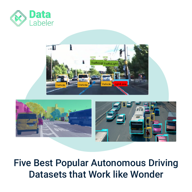
As automotive companies are competing to achieve level 5 autonomy for vehicles and high-quality drivers training has acquired a vital status in the development process. Multiple players are closer to training or labeling data because we all are aware that artificial intelligence and Machine Learning models are the best for training datasets. Labeled datasets are designed specifically for autonomous problems which tend to help Machine Learning teams to achieve better success in solving the predefined problems.
However, it is also understandable that everyone could not afford to invest heavily in creating special training datasets.
Here is a list of the top five open datasets which you can start using immediately:
The Oxford Radar Robot car dataset is made up of more than a hundred repetitions of a consistent root via Oxford the UK which has been captured for over one year. This data set is nothing but a combination of several different combinations of pedestrian traffic weather along with long-term changes like road works and constructions.
The Waymo Open dataset is an open-source high-quality multi-modal censored date of death for autonomous driving. This data set is extracted from more self-driving vehicles which cover a wide variety of environments starting from dense urban centers to Suburban landscapes. It comprises multiple timeframes which include sunshine, rain, dawn, and dusk. This dataset also contains a thousand types of multiple segments where each segment captures 20 seconds of continuous driving which is corresponding to 2,00,000 frames at 10 Hz per sensor.
It is a comprehensive large-scale data set that features LiDAR sensor cameras that feature autonomous vehicles in several restricted geographical areas. This dataset also includes high-quality labels 3D bounding boxes of multiple traffic agents. Level 5 open data includes more than 55k human-label three-dimensional surface maps underlying high definition spatial semantic maps which are captured by seven cameras and 3 LiDAR sensors that are used to contextualize the data.
Google published landmark status in 2018. Google landmarks dataset is further divided into two sets of images for evaluating the organization and ritual of human-made or natural landmarks. The original dataset comprises more than 2 million images depicting 30 thousand unique from across the world. In 2019 Google marked landmark version 2 as an even more massive data set with 5 million images and 200k landmarks.
It is part of the Apollo project which is an evolving research project that aims to Foster innovations across all aspects of autonomous driving. Starting from perception to navigation as well as control. Through the website, users can explore several simulation tools and more than 100K street-view frames, 1000 km trajectories for urban traffic, and 80k lidar point cloud.
Final Thoughts:
Global directions are onwards making more data available and accessible to the research and Machine Learning experts. In turn, new data experts will continue to grow and make data accessible to the crowdsource, and computer science experts would continue to create innovative solutions for everyday life.
About Us:
Data Labeler could help you with convenient, customized, expedited, and quality-labeled datasets for Machine Learning and AI initiatives. Data Labeler helps you enhance your competitive advantage and increases your exponential growth.
Want to know more about training datasets for Machine Learning? Contact Us
 admin
admin
 October 18, 2021